Monday, June 29, 2009
Thursday, June 11, 2009
BANGLADESH COX'S BAZAR
BANGLADESH COX'S BAZAR:


MORE BANGLADESH COX'S BAZAR WEBSITES
| Cox's Bazar | |
 | |
 | |
| Coordinates: 21°35′0″N 92°01′0″E / 21.58333°N 92.01667°E | |
| Country | |
|---|---|
| Administrative District | Cox's Bazar District |
| Area | |
| - City | 6.85 km2 (2.6 sq mi) |
| Population (2007 est.)Total population represents population in city and metro represents entire district. | |
| - City | 51,918 |
| - Density | 7,579.27/km2 (19,630.2/sq mi) |
| - Metro | 120,480 |
| Time zone | BST (UTC+6) |

'This article is about the city. For the district, see Cox's Bazar District.

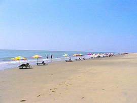
Cox's Bazar beach regarded as world's longest natural beach.
Cox's Bazar (Bengali: কক্স বাজার Kôksho Bajar or Kôks Bazar) is a town, a fishing port and district headquarter in Bangladesh. It is known for its wide sandy beach which is claimed to be the world's longest natural sandy sea beach. [It is an unbroken 125 km sandy sea beach with a gentle slope. Since the rise and fall of the tide here is not great, it is a good place for sea bathing[5]. It is located 150 km south of Chittagong. Cox’s Bazar is also known by the name "Panowa", the literal translation of which means "yellow flower". Its other old name was "Palongkee". The modern Cox's Bazar derives its name from Captain Cox (died 1799), an officer serving in British India. In the 18th century, an officer of British East India Company, Captain Hiram Cox was appointed as the Superintendent of Palongkee outpost after Warren Hastings became the Governor of Bengal. Captain Cox pie was specially mobilized to deal with a century long conflict between Arakan refugees and local Rakhains. The Captain was a compassionate soul and the plight of the people touched his heart. He embarked upon the mammoth task of rehabilitating refugees in the area, and made significant progress. A premature death took Captain Cox in 1799 before he could finish his work. But the work he had done earned him a place in the hearts of the locals and to commemorate his role in rehabilitation work a market was established and named after him as Cox's Bazaar ("Cox's Market"). Although Cox's Bazar is one of the most visited tourist destinations in Bangladesh, it has yet to become a major international tourist destination, due to lack of publicity.
| |
The Town
Located along the Bay of Bengal in South Eastern Bangladesh, Cox's Bazar Town is a small port and health resort. But it is mostly famous for its long natural sandy beach. The municipality covers an area of 6.85 km² with 27 mahallas and 9 wards and has a population of 51,918. Cox's Bazar is connected by road and air with Chittagong.
History
The greater Chittagong area including Cox's Bazar was under the rule of Arakan Kings from the early 9th century till its conquest by the Mughals in 1666 AD. When the Mughal Prince Shah Shuja was passing through the hilly terrain of the present day Cox’s Bazar on his way to Arakan, he was attracted to the scenic and captivating beauty of the place. He commanded his forces to camp there. His retinue of one thousand palanquins stopped there for some time. A place named Dulahazara, meaning "one thousand palanquins", still exists in the area. After the Mughals, the place came under the control of the Tipras and the Arakanese, followed by the Portuguese and then the British.
The name Cox's Bazar/Bazaar originated from the name of a British East India Company officer, Captain Hiram Cox who was appointed as the Superintendent of Palonki (today's Cox's Bazar) outpost after Warren Hastings became the Governor of Bengal following the British East India Company Act in 1773. Captain Cox was especially mobilized to deal with a century long conflict between Arakan refugees & local Rakhains at Palonki. The Captain made significant progress in rehabilitation of refugees in the area, but had died (in 1799) before he could finish his work. To commemorate his role in rehabilitation work a market / bazaar was established and was named after him as Cox's Bazaar (market of Cox). Cox's Bazar thana was first established in 1854 and a municipality was constituted in 1869.
After the Sepoy Mutiny (Indian Rebellion of 1857) in 1857, the British East India Company was highly criticized & questioned in humanitarian ground specially for its Opium trade monopoly over the Indian Sub-Continent. However after getting dissolved on January 1, 1874, all of company's assets including its Armed Forces were acquired by the British Crown. After this historic take over, Cox's Bazar was declared as a district of the Bengal Province under the British Crown.

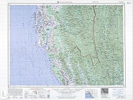
Cox's Bazar Map from Series U542, U.S. Army Map Service, 1955
After the end of British rule in 1947, Cox's Bazar remained as a part of East Pakistan. Captain Advocate Fazlul Karim, the first Chairman (after independence from the British) of Cox's Bazar Municipality established the Tamarisk Forest along the beach to draw tourist attention in this town and also to protect the beach from tidal waves. He also donated many of his father in law’s and his own lands for establishing a Public Library and a Town Hall for the town. He was inspired to build Cox's Bazar as a tourist spot after seeing beaches of Bombay and Karachi, and one of the pioneers in developing Cox's Bazar as such. He founded a Maternity Hospital, the Stadium and the drainage system by procuring grants from the Ford Foundation and Rockefeller Foundation through correspondence. Mr. T. H. Matthews, the principal of the Dacca Engineering College (1949~1954) was his friend who had helped him in doing this. Engineer Chandi Charan Das was the government civil engineer who had worked on all these projects. In 1959 the municipality was turned into a town committee.In 1961 the erstwhile Geological Survey of Pakistan initiated investigation of radioactive minerals like monazite around the cox's bazar sea-beach area and a number of precious heavy minerals were identified the same year.

Cox's Bazar Bus Terminal

Submarine Cable Landing Station
In 1971, Cox's bazar wharf was used as a naval port by the Pakistan Navy's gunboats. This and the nearby airstrip of the Pakistan Air Force were the scene of intense shelling by the Indian Navy during Bangladesh Liberation War. During the war, Pakistani soldiers killed many people in the town including eminent lawyer Jnanendralal Chowdhury. The killing of two freedom fighters named Farhad and Subhash at Badar Mokam area is also recorded in history.
After the independence of Bangladesh Cox's Bazar started to get the administrative attention. In 1972 the town committee of Cox's Bazar was again turned into a municipality. In 1975, The Government of Bangladesh established a pilot plant at Kalatali, Cox's Bazar to assess the commercial viability of the heavy mineral content in the placer deposits of the area with the cooperation of the Australian Government.Later, in 1984 Cox's Bazar subdivision was promoted to a district and 5 years later (in 1989) the Cox's Bazar municipality was elevated to B-grade. In 1994 (jobs) the Marine Fisheries and Technology Station (MFTS) was established at Cox's Bazar. MFTS is a research station of Bangladesh Fisheries Research Institute (BFRI) headquartered in Mymensingh. The station covers a land area of 4 hactor and is equipped with 5 specialized laboratories, and one indoor and one outdoor cistern complex. In April 2007 Bangladesh got connected to the submarine cable network as a member of the SEA-ME-WE-4 Consortium, as Cox's Bazar was selected as the landing station of the submarine cable.
Geography and climate

Panorama of Cox's Bazar in the early morning: clouds on a blue sky, still water and forest in the distance.
Cox's Bazar town with an area of 6.85 km², is located at 21°35′0″N 92°01′0″E / 21.58333°N 92.01667°E and bounded by Bakkhali River on the north and East, Bay of Bengal in the West, and Jhilwanj Union in the south.
The climate of Bangladesh is mostly determined by its location in the tropical monsoon region: high temperature, heavy rainfall, often excessive humidity, and distinct seasonal variations. The reversal of the wind circulation between summer and winter is another important feature of the climate of the country. The climate of Cox's bazar is mostly similar to the rest of the country. It is further characterized by the location in the coastal area. The annual average temperature in Cox's Bazar remains at about a maximum of 34.8 °C and a minimum of 16.1 °C. The average amount of rainfall remains at 4,285 mm.
| [hide]Climate in Cox's Bazar | |||||||||||||
|---|---|---|---|---|---|---|---|---|---|---|---|---|---|
| Month | Jan | Feb | Mar | Apr | May | Jun | Jul | Aug | Sep | Oct | Nov | Dec | |
| Avg high temperature (°F) | 80° | 83° | 87° | 90° | 91° | 87° | 86° | 86° | 87° | 87° | 85° | 80° | |
| Avg low temperature (°F) | 57° | 61° | 68° | 75° | 78° | 77° | 81° | 77° | 77° | 75° | 67° | 60° | |
| Average Precipitation (inches) | 0.1" | 0.5" | 1.5" | 4.2" | 12.7" | 31.1" | 35.5" | 27.8" | 15.3" | 7.2" | 3.3" | 1.0" | |
| Source: WeatherBase.Com; Retrieved on 2008-01-25 | |||||||||||||
Economy and development
As a most beautiful and famous tourist spot of Bangladesh, the major source of economy of Cox's Bazar is tourism. Millions of foreigners and Bangladeshi natives visit this
File:Marine drive road.jpg
Part of Marine drive road
coastal city every year. Therefore, a number of hotel, guest house, and motel have been built in the city and coastal region. Many people are involved in these hospitality and customer service type business. A number of people are also involved in fishing and collecting seafood and sea products for their livelihood. Out of several sea products various kinds of Oyster, Snail, Pearl and their ornaments are very popular to tourists in the seaside and city stores. A number of people are also involved in the transportation business for tourists. Cox's Bazar is also one of the few major spots for aquaculture in Bangladesh. Along with Khulna, it is considered as a major source of foreign exchange earning of the country from this sector. Besides, a mix of small-scale agriculture, marine and inland fishing and salt production are other industrial sources from this region that plays important role in the national economy.
Tourist attractions near the town

Local hotels arrange beachside accessories for the tourists at Cox's Bazar
The beach is the main attraction of the town. Larger hotels provide exclusive beachside area with accessories for the hotel guests. Visitors in other hotels visit the Laboni beach which is the area of the beach closest to the town. Other than the beach there are several places of interest near the town which can easily be visited from town center.
- Aggmeda Khyang: a large Buddhist monastery, and a place revered by around 400,000 Buddhist people of Cox’s Bazar; and the Chittagong Hill Tracts. The main sanctuary is posted on a series of round timber columns. It has a prayer chamber and an assembly hall along with a repository of large and small bronze Buddha images and a number of old manuscripts.
- Ramu: about 10 km from Cox’s Bazar, is a village with a sizeable Buddhist population. The village is famous for its handicrafts and homemade cigars. There are monasteries, khyangs and pagodas containing images of Buddha in gold, bronze and other metals inlaid with precious stones. One of the most interesting of these temples is on the bank of the Baghkhali river. It houses not only interesting relics and Burmes handicrafts but also a large bronze statue of Buddha measuring thirteen feet high and rests on a six feet high pedestal. The wood carving of this khyang is very delicate and refined. The village has a charm of its own. Weavers ply their trade in open workshops and craftsmen make handmade cigars in their pagoda like houses.
- Dulhazra Safari Park: This safari park is an extension of an animal sanctuary located along the Chittagong-Cox's Bazar road about 50 km from Cox's Bazar town. The sanctuary itself protects a large number of wild elephants which are native to the area. In the safari park there are domesticated elephants which are available for a ride. Other animal attractions include lions, Bengal tigers, Crocodiles, Bears, Chitals and lots of different types of birds and monkeys.
Risks and Hazards
The coastal areas of Cox's Bazar are prone to devastating cyclones and landslides on a yearly basis. The areas near the Cox’s Bazar town are located directly in the high risk area for surge water heights above 1 meter as well as landslides.There was a 70% casualty rate near the town area during the 1991 cyclone. Another hazard of the Cox's Bazar area is the high natural background radiation which has been found to be above global average. There has been reported incidents of human casualty due to actions of wild elephants in the locality. The threat of mosquito borne diseases like Malaria also may be higher in the area. However, all these hazards mainly affect long term residents of the area and visiting tourists should be able to guard against these risks with appropriate precautions.
The beach
File:Tourist at Enani .jpg
Tourist at Enani Bridge.
The main attraction of Cox's Bazar is the long sandy beach that stretches from the mouth of the Bakkhali river going all the way to Teknaf. Although commonly known as Cox's Bazar beach, it stretches far beyond the area designated as Cox's Bazar town.
Tourists and accommodation
Cox's Bazar, arguably the best tourist spot in Bangladesh, is visited by a large number of tourist from Britain, America, Korea, Japan, India, Nepal, Pakistan and many more countries each year. Though there is no specific record in Bangladesh Porjatan Corporation (BPC) on how many people usually visit Cox's Bazar each year but an AFP report says that during the winter 10,000 available rooms in the beach area hotels usually remain occupied almost seven days a week.Accommodation near the beach varies from an expensive range to a reasonable price. Many private hotels, BPC Motels and two Five Star hotels are located near the beach.
Places of interest along the beach
Cox’s Bazar, mostly famous for its beautiful sea beach and the sunset, has several other attractions, including:

Himchari
- Laboni Beach: This is the main beach of Cox's Bazar and is considered the main beach due to the fact that it is closest to the town. Close to the beach, there are hundreds of small shops selling souvenirs and beach accessories to the tourists.
- Himchari: Located about 18 km south of Cox’s Bazar along the sea beach, is a nice place for the picnic and film shooting. This picnic spot is famous for its waterfalls. The road to Himchari runs by the open sea on one side and hills on the other which makes the journey to Himchari very attractive. Its another attraction is the Christmas tree.
- Enani Beach: Located 35 km south of Cox’s Bazar, this white sandy beach is located within Ukhia Thana. This beach is famous for its golden sand and clean shark free water which is ideal for sea bathing. Most tourists prefer to come down here for relaxing because it is free from the crowd of tourists that is usually seen at the Laboni beach.
Mineral content in beach sand
The sand at Cox's Bazar beach and surrounding areas is rich in heavy-metal mineral content.[22] The heavy minerals of Cox's Bazar beach sands are dominated by hornblende, garnet, epidote, ilmenites (both unaltered and altered) with magnetite, rutile, pyrite and some hydroxides.[23] Cox's Bazar beach alone is believed to have a deposit of 5.119 Mt of minerals @ 0.04% mon, while nearby Enani beach is expected to have another deposit of 0.729 Mt. of minerals @ 0.13% mon. Surrounding islands of Maheshkhali, Kutubdia and Nijhum Deep as well as mainland beach in Teknaf area are also believed to have similar large deposits. The total deposit in these locations is about 20.5 million tons of raw sand, which contains 4.4 million tons of heavy minerals (sp gr > 2.9).
Other tourist attractions near Cox's Bazar
File:Naff river.jpg
View of Naff river (near Teknaf)
- Maheshkhali is a small island (268 square kilometres) off the Cox’s Bazar coast. The island offers panoramic scenic beauty and is covered by a range of low hills, about 300 feet (91 m) high, streatches through the center of the island and along its eastern coastline. The coasts of the island on the west and north form a low-lying tract that is fringed by the mangrove forests.[24] Adinath Temple, a temple of Shiva, and a Buddhist pagoda are also located on this island.
- Sonadia Island, a small crescent shaped island of only 9 square kilometers, it is 7-km north-west of Cox's Bazar. The western side of the island is sandy and different kinds of shells are found on the beach. Off the northern part of the island, there are beds of window pane oysters. During winter, fisherman set up temporary camps on the island and dry their catches of sea fish. Sonadia Island supports the last remaining part of mangrove forest in southeast Bangladesh. Sonadia's mangroves are distinct from the well-known sunderbans, due to their development in a coastal lagoon setting rather than in a delta. Another attraction of this island is the sight of game birds migrating here in great numbers during the winter seasons.
- y the side of Naf river is the southernmost part of mainland Bangladesh. This also marks the end point of Cox's Bazar beach. Tourists usually come here to have a river cruise along beautiful Naf river, which flows between Bangladesh and Myanmar.

Dead corals at St. Martins Island.
- St. Martin's Island, a small island in the northeast part of the Bay of Bengal, about 9 km south of the tip of the Cox's Bazar-Teknaf peninsula. It is the only coral island in Bangladesh. It is about 8 km west of the northwest coast of Myanmar at the mouth of the Naf River. The local name of the island is "Narical Gingira", also spelled "Narikel Janjina/Jinjera", translated from Bangla, meaning 'Coconut Island'. St. Martin's Island has become a popular tourist spot. Three shipping liners run daily trips to the island. They are Kutubdia, Sea-Truck and Keary-Sindbad. Tourists can book their trip either from Chittagong or from Cox's Bazar. The surrounding coral reef of the island has an extension named Chera Dwip. The island is home to several endagered species of turtles, as well as the corals, some of which are found only on this island.
- Chakaria: One of most large area in Cox's Bazar.
- Bandarban: Bandarban lies three hours away from Cox's Bazaar by bus. The Buddha Dhatu Jadi, the largest Buddhist temple in Bangladesh, located in Balaghata, 4 km from the town, is an excellent place to visit. This Theravada Buddhist temple is made completely in the style of South-East Asia and houses the second largest statue of Buddha in Bangladesh. The waterfall named Shoilo Propat at Milanchari is also an excellent site. In addition, the numerous Buddhist temples, known as kyang in local tongue, and vihars in the town include the highly notable the Rajvihar (royal vihar) at Jadipara and the Ujanipara Vihar. Bawm villages around Chimbuk, and Mru villages a little further off, are also lie within a day's journey from the town. Prantik Lake, Jibannagar and Kyachlong Lake are some more places of interest. And, a boat ride on the river Sangu is also an excellent proposition.

Kaptai Lake at Rangamati.
- Rangamati: One can reach Rangamati from Cox's Bazar either via Chittagong or Bandarban. Rangamati offers several attractions including local tribal museum, Buddhist temple, tribal markets, hanging bridge and even the palace of traibal kings. The major attraction of the district is Kaptai Lake. It is a man-made lake in the Kaptai upazila of Rangamati District. The lake was created as a result of building the Kaptai Dam on the Karnaphuli River, as part of the Karnaphuli Hydro-electric project. The beautiful view of surrounding green hills has turned the lake into a wonderful spot for boating and cruising.
MORE BANGLADESH COX'S BAZAR WEBSITES
BANGLADESH SUNDARBANS
BANGLADESH SUNDARBANS:


 | |
| State Party | Bangladesh, |
| Type | Natural |
| Criteria | ix, x |
| Reference | 798 |
| Region** | Asia |
| Inscription history | |
| Inscription | 1997 (21st Session) |
| * Name as inscribed on World Heritage List. ** Region as classified by UNESCO. | |
The Sundarbans (Bengali: সুন্দরবন Shundorbôn) is the largest single block of tidal halophytic mangrove forest in the world. The name Sundarban can be literally translated as "beautiful jungle" or "beautiful forest" in the Bengali language (Sundar, "beautiful" and bans, "forest" or "jungle"). The name may have been derived from the Sundari trees that are found in Sundarbans in large numbers. Alternatively, it has been proposed that the name is a corruption of Samudraban (Bengali: সমুদ্রবন Shomudrobôn "Sea Forest") or Chandra-bandhe (name of a primitive tribe). But the generally accepted view is the one associated with Sundari trees.[1]
The forest lies at the feet of the Ganges and is spread across areas of Bangladesh and West Bengal, India, forming the seaward fringe of the delta. The seasonally-flooded Sundarbans freshwater swamp forests lie inland from the mangrove forests. The forest covers 10,000 km2 of which about 6,000 are in Bangladesh. It became inscribed as a UNESCO world heritage site in 1997, but while the Bangladeshi and Indian portions constitute the same continuous ecotope, these are separately listed in the UNESCO world heritage list as the Sundarbans and Sundarbans National Park, respectively. The Sundarbans is intersected by a complex network of tidal waterways, mudflats and small islands of salt-tolerant mangrove forests. The area is known for the eponymous Royal Bengal Tiger (Panthera tigris tigris), as well as numerous fauna including species of birds, spotted deer, crocodiles and snakes. It is estimated that there are now 500[citation needed] Bengal tigers and about 30,000 spotted deer in the area. Sundarbans was designated a Ramsar site on May 21, 1992. The fertile soils of the delta have been subject to intensive human use for centuries, and the ecoregion has been mostly converted to intensive agriculture, with few enclaves of forest remaining. The remaining forests, together with the Sundarbans mangroves, are important habitat for the endangered tiger. Additionally, the Sundarbans serves a crucial function as a protective flood barrier for the millions of inhabitants in and around Kolkata (Calcutta) against the result of cyclone activity.
History
During the Mughal period, local kings leased the forests of the Sundarbans to residents. The legal status of the forests underwent a series of changes, including the distinction of being the first mangrove forest in the world to be brought under scientific management. The area was mapped by the Surveyor General as early as 1764 following soon after proprietary rights were obtained from the Mughal Emperor, Alamgir II, by the East India Company in 1757. Systematic management of this forest tract started in the 1860s after the establishment of a Forest Department in the Province of Bengal, in India.
The first Forest Management Division to have jurisdiction over the Sundarbans was established in 1869. The Sundarbans was declared a reserved forest in 1875-76, under the Forest Act, 1865 (Act VIII of 1865). The first management plan was written for the period 1893-98. In 1875 a large portion of the mangrove forests was declared as reserved forests under the Forest Act, 1865 (Act VIII of 1865). The remaining portions of forests was declared as reserve forest the following year and the forest, which was so far was administered by the civil administration district, was placed under the control of the Forest Department. A Forest Division, which is the basic forest management and administration unit, was created in 1879 with the headquarter in Khulna.
In 1911, it was described as a tract of waste country which had never been surveyed, nor had the census been extended to it. It then stretched for about 165 miles (266 km) from the mouth of the Hugli to the mouth of the Meghna and was bordered inland by the three settled districts of the 24 Parganas, Khulna and Backergunje. The total area (including water) was estimated at 6,526 square miles (16,902 km2). It was a water-logged jungle, in which tigers and other wild beasts abounded. Attempts at reclamation had not been very successful. The characteristic tree was the sundari (Heritiera littoralis), from which the name of the tract had probably been derived. It yields a hard wood, used for building, and for making boats, furniture, etc. The Sundarbans were everywhere intersected by river channels and creeks, some of which afforded water communication between Calcutta and the Brahmaputra Valley, both for steamers and for native boats.
Physiography

This satellite image shows the forest in the protected area. The Sundarbans appears deep green, surrounded to the north by a landscape of agricultural lands, which appear lighter green, towns, which appear tan, and streams, which are blue.

A map of the Indian Sunderbans, showing the boundaries of the protected areas, conservation and lodging centres, subsistence towns, and access points
The mangrove-dominated Ganges Delta – the Sundarbans - is a complex ecosystem comprising one of the three largest single tract of mangrove forests of the world. Shared between two neighbouring countries, Bangladesh and India, the larger part (62%)is situated in the southwest corner of Bangladesh. To the south the forest meets the Bay of Bengal; to the east it is bordered by the Baleswar River and to the north there is a sharp interface with intensively cultivated land. The natural drainage in the upstream areas, other than the main river channels, is everywhere impeded by extensive embankments and polders. The Sundarbans was originally measured (about 200 years ago) to be of about 16,700 km². Now it has dwindled to about 1/3 of the original size. The total land area today is 4,143 km² (including exposed sandbars: 42 km²) and the remaining water area of 1,874 km² encompasses rivers, small streams and canals. Rivers in the Sundarbans are meeting places of salt water and freshwater. Thus, it is a region of transition between the freshwater of the rivers originating from the Ganges and the saline water of the Bay of Bengal (Wahid et al.. 2002).
The Sundarbans along the Bay of Bengal has evolved over the millennia through natural deposition of upstream sediments accompanied by intertidal segregation. The physiography is dominated by deltaic formations that include innumerable drainage lines associated with surface and subaqueous levees, splays and tidal flats. There are also marginal marshes above mean tide level, tidal sandbars and islands with their networks of tidal channels, subaqueous distal bars and proto-delta clays and silt sediments. The Sundarbans' floor varies from 0.9 m to 2.11 m above sea level.
Biotic factors here play a significant role in physical coastal evolution and for wildlife a variety of habitats have developed including beaches, estuaries, permanent and semi-permanent swamps, tidal flats, tidal creeks, coastal dunes, back dunes and levees. The mangrove vegetation itself assists in the formation of new landmass and the intertidal vegetation plays an important role in swamp morphology. The activities of mangrove fauna in the intertidal mudflats develop micromorphological features that trap and hold sediments to create a substratum for mangrove seeds. The morphology and evolution of the eolian dunes controlled by an abundance of xerophytic and halophytic plants. Creepers and grasses and sedges stabilizes sand dunes and uncompacted sediments.
Ecoregions
Sundarbans features two ecoregions — "Sundarbans freshwater swamp forests" (IM0162) and Sundarbans mangroves (IM1406).
The Sundarbans freshwater swamp forests are a tropical moist broadleaf forest ecoregion of India and Bangladesh. It represents the brackish swamp forests that lie behind the Sundarbans Mangroves where the salinity is more pronounced. The freshwater ecoregion is an area where the water is only slightly brackish and becomes quite fresh during the rainy season, when the freshwater plumes from the Ganges and Brahmaputra rivers push the intruding salt water out and also bring a deposit of silt. It covers an area of 14,600 square kilometers (5,600 square miles) of the vast Ganges-Brahmaputra Delta, extending from India's West Bengal state into western Bangladesh. The Sundarbans freshwater swamp forests lie between the upland Lower Gangetic plains moist deciduous forests and the brackish-water Sundarbans mangroves bordering the Bay of Bengal.
The fertile soils of the delta have been subject to intensive human use for centuries, and the ecoregion has been mostly converted to intensive agriculture, with few enclaves of forest remaining. The remaining forests, together with the Sundarbans mangroves, are important habitat for the endangered Bengal Tiger (Panthera tigris). In addition to the endangered tiger, there are several other threatened mammal species, such as the capped langur (Semnopithecus pileatus), smooth-coated otter (Lutrogale perspicillata), Oriental small-clawed otter (Aonyx cinerea), and great Indian civet (Viverra zibetha). The ecoregion also contains the leopard (Panthera pardus) and several smaller predators such as the jungle cat (Felis chaus), fishing cat (Prionailurus viverrinus), and leopard cat (Prionailurus bengalensis).
This ecoregion is nearly extinct, the victim of large-scale clearing and settlement to support one of the densest human populations in Asia. Hundreds of years of habitation and exploitation by one of the world's densest human populations have exacted a heavy toll of this ecoregion's habitat and biodiversity. There are two protected areas — Narendrapur (110 km2) and Ata Danga Baor (20 km2) that cover a mere 130 km2 of the ecoregion. Habitat loss in this ecoregion is so extensive, and the remaining habitat is so fragmented, that it is difficult to ascertain the composition of the original vegetation of this ecoregion. According to Champion and Seth (1968), the freshwater swamp forests are characterized by Heritiera minor, Xylocarpus molluccensis, Bruguiera conjugata, Sonneratia apetala, Avicennia officinalis, and Sonneratia caseolaris, with Pandanus tectorius, Hibiscus tiliaceus, and Nipa fruticans along the fringing banks.
The Sundarbans Mangroves ecoregion is the world's largest mangrove ecosystem, with 20,400 square kilometers (7,900 square miles) of area covered. Named after the dominant mangrove species Heritiera fomes, locally known as sundri, it lies in the vast delta formed by the confluence of the Ganges, Brahmaputra, and Meghna rivers across southern Bangladesh and Indian state of West Bengal. This is the only mangrove ecoregion that harbors the Indo-Pacific region's largest predator, the Bengal Tiger. Unlike in other habitats, here tigers live and swim among the mangrove islands, where they hunt scarce prey such as chital deer (Cervus axis), barking deer (Muntiacus muntjak), wild pig (Sus scrofa), and even macaques (Macaca mulatta). Mangroves are a transition from the marine to freshwater and terrestrial systems. They provide critical habitat for numerous species of fishes and crustaceans that are adapted to live, reproduce, and spend their juvenile lives among the tangled mass of roots, known as pneumatophores, that grow upward from the anaerobic mud to get the trees' supply of oxygen.
Mangroves are not diverse compared with most other terrestrial ecosystems. The undisturbed forests have an unstratified, dense canopy and an undergrowth made up of seedlings and saplings of the canopy trees. In the Sundarbans, the mangrove forests are characterized by Sundari, a species valued for its timber. Other species that make up the forest assemblage include Avicennia spp., Xylocarpus mekongensis, Xylocarpus granatum, Sonneratia apetala, Bruguiera gymnorrhiza, Cereops decandra, Aegiceras corniculatum, Rhizophora mucronata, and Nypa fruticans palms. Several predators dwell in this labyrinth of channels. Two species of crocodiles — Crocodylus porosus and Crocodylus palustris — dwell here, as well as the Gangetic gavial (Gavialis gangeticus), and the water monitor lizard (Varanus salvator) use both land and water to hunt and bask in. Sharks and the Gangetic freshwater dolphins (Platanista gangetica) inhabit the waterways. And several birds of prey patrol the sky overhead. More cryptic but equally fascinating are the mudskippers, a gobioid fish that climbs out of the water into mudflats and even climbs trees. An abundance of crabs, hermit crabs, and shrimp scavenge among the roots.
As Bangladesh supports one of the world's highest human population densities, the population pressure resulted in half of this ecoregion's mangrove forests cut down to supply the fuelwood and other natural resources extracted from these forests by this large population. Despite the intense and large-scale exploitation, the ecoregion still is one of the largest contiguous areas of mangroves in the world. There are seven protected areas — Sajnakhali (2,090 km2), Sundarbans East (210 km2), Char Kukri-Mukri (30 km2), Sundarbans South (200 km2), Sundarbans West (130 km2), Halliday Island (4 km2), Lothian Island (20 km2) — that cover almost 2,700 km2, or 15 percent of the ecoregion. Among these only Sajnakhali is large enough to support a space-dependent species such as the tiger.
Climate change impact

Mudflats in Sundarbans
The physical development processes along the coast are influenced by a multitude of factors, comprising wave motions, micro and macro-tidal cycles and long shore currents typical to the coastal tract. The shore currents vary greatly along with the monsoon. These are also affected by cyclonic action. Erosion and accretion through these forces maintains varying levels, as yet not properly measured, of physiographic change whilst the mangrove vegetation itself provides a remarkable stability to the entire system. During each monsoon season almost all the Bengal Delta is submerged, much of it for half a year. The sediment of the lower delta plain is primarily advected inland by monsoonal coastal setup and cyclonic events. One of the greatest challenges people living on the Ganges Delta may face in coming years is the threat of rising sea levels caused mostly by subsidence in the region and partly by climate change.
In many of the Indian mangrove wetlands, freshwater reaching the mangroves was considerably reduced from the late 19th century due to diversion of freshwater in the upstream area. Also, the Bengal Basin is slowly tilting towards the east due to neo-tectonic movement, forcing greater freshwater input to the Bangladesh Sundarbans. As a result, the salinity of the Bangladesh Sundarbans is much lower than that of the Indian Sundarbans. A 1990 study noted that there "is no evidence that environmental degradation in the Himalayas or a 'greenhouse' induced rise in sea level have aggravated floods in Bangladesh"; however, a 2007 report by UNESCO, "Case Studies on Climate Change and World Heritage" has stated that an anthropogenic 45-cm rise in sea level (likely by the end of the 21st century, according to the Intergovernmental Panel on Climate Change), combined with other forms of anthropogenic stress on the Sundarbans, could lead to the destruction of 75% of the Sundarbans mangroves.
Flora

Sundari tree
The Sundarbans flora is characterized by the abundance of Heritiera fomes, Excoecaria agallocha, Ceriops decandra and Sonneratia apetala. A total 245 genera and 334 plant species were recorded by David Prain in 1903. Since Prain’s report there have been considerable changes in the status of various mangrove species and taxonomic revision of the man-grove flora. However, very little exploration of the botanical nature of the Sundarbans has been made to keep up with these changes. Whilst most of the mangroves in other parts of the world are characterized by members of the Rhizophoraceae, Avicenneaceae or Laganculariaceae, the mangroves of Bangladesh are dominated by the Sterculiaceae and Euphorbiaceae.
The Bangladesh mangrove vegetation of the Sundarbans differs greatly from other non-deltaic coastal mangrove forest and upland forests associations. Unlike the former, the Rhizophoraceae are of minor importance. Differences in vegetation have been explained in terms of freshwater and low salinity influences in the Northeast and variations in drainage and siltation. The Sundarbans has been classified as a moist tropical forest demonstrating a whole mosaic of seres, comprising primary colonization on new accretions to more mature beach forests, often conspicuously dominated by Keora (Sonneratia apetala) and tidal forests. Historically three principal vegetation types have been recognized in broad correlation with varying degrees of water salinity, freshwater flushing and physiography and which are represented in the wildlife sanctuaries:
Sundari and Gewa occur prominently throughout the area with discontinuous distribution of Dhundul (Xylocarpus granatum) and Kankra. Among grasses and Palms, Poresia coaractata, Myriostachya wightiana, Imperata cylindrica, Phragmites karka, Nypa fruticans are well distributed. Keora is an indicator species for newly accreted mudbanks and is an important species for wildlife, especially spotted deer (Axis axis). Besides the forest, there are extensive areas of brackish and freshwater marshes, intertidal mudflats, sandflats, sand dunes with typical dune vegetation, open grassland on sandy soils and raised areas supporting a variety of terrestrial shrubs and trees.
Succession is generally defined as the successive occupation of a site by different plant communities.In an accreting mudflats the outer community along the sequence represents the pioneer community which is gradually replaced by the next community representing the seral stages and finally by a climax community typical of the climatic zone. Troup suggested that succession began in the newly accreted land created by fresh deposits of eroded soil.
The pioneer vegetation on these newly accreted site is Sonneratia, followed by Avicennia and Nypa. As the ground is elevated as a result of soil deposition, other trees make their appearance. The most prevalent, though one of the late species to appear, is Excoecaria. As the level of land rises through accretion and the land is only occasionally flooded by tides, Heritiera fomes begins to appear.
Fauna


The Sundarbans is very rich in wildlife. The management of wildlife is presently restricted to the protection of fauna from poaching and designation of some areas as wildlife sanctuaries where no extraction of forest produce is allowed and the wildlife face few disturbances. Although the fauna of Bangladesh have diminished in recent times and the Sundarbans has not been spared from this decline, the mangrove forest retains several good wildlife habitats and their associated fauna. Of these the tiger and dolphin are target species for planning wildlife management and tourism development. There are high profile and vulnerable mammals living in two contrasting environments and their statuses and management are strong indicators of the general condition of wildlife and its management. The Sundarbans were home to approximately 500 Bengal tigers in 2004, one of the largest single populations of tigers.

Blue-eared Kingfisher sighted in the Sundarbans.
The Sundarbans provide a unique ecosystem and wildlife habitat. The river terrapin (Batagur baska), Indian flap-shelled turtle (Lissemys punctata), peacock soft-shelled turtle (Trionyx hurum), yellow monitor (Varanus flavescens), water monitor (Varanus salvator), Indian python (Python molurus) and the Bengal tiger (Panthera tigris tigris) are some of the resident species. Some of these species are protected by legislation, notably by the Bangladesh Wildlife (Preservation) Order, 1973 (P.O. 23 of 1973). Some species such as hog deer (Axis porcinus), water buffalo (Bubalus bubalis), swamp deer (Cervus duvauceli), Javan rhinoceros (Rhinoceros sondaicus), single horned rhinoceros (Rhinoceros unicornis) and the mugger crocodile (Crocodylus palustris) have become extinct in the Sundarbans at the beginning of the last century.[16]
Recent studies revealed that the Bangladesh Sundarbans support diverse biological resources including at least 120 species of commercially important fishes, 270 species of birds, 42 species of mammals, 35 reptiles and eight amphibian species. This represents a significant proportion of the species present in Bangladesh (i.e. about 30% of the reptiles, 37% the birds and 34% of the mammals) and includes a large number of species which are now extinct elsewhere in the country. Two amphibians, 14 reptiles, 25 aves and five mammals are presently endangered. The Sundarbans is an important wintering area for migrant water birds and is an area suitable for watching and studying avifauna.
The Sundarbans were home to approximately 500 Bengal tigers in 2004, one of the largest single population of tigers. Tiger attacks are frequent in the Sundarbans. Between 100 and 250 people are killed per year. However, owing to various measures taken for safety, there have been no reports of deaths since 2004 in the Indian portion of the Sundarbans[citation needed].
Economy


The Sundarbans has a population of over 4 million but much of it is mostly free of permanent human habitation.
The Sundarbans play an important role in the economy of the southwestern region of Bangladesh as well as in the national economy. It is the single largest source of forest produce in the country. The forest provides raw material for wood based industries. In addition to traditional forest produce like timber, fuelwood, pulpwood etc., large scale harvest of non wood forest products such as thatching materials, honey, bees-wax, fish, crustacean and mollusk resources of the forest takes place regularly. The vegetated tidal lands of the Sundarbans also function as an essential habitat, nutrient producer, water purifier, nutrient and sediment trap, storm barrier, shore stabilizer, energy storage unit and aesthetic attraction.
The forest also has immense protective and productive functions. Constituting 51% of the total reserved forest estate of Bangladesh it contributes about 41% of total forest revenue and accounts for about 45% of all timber and fuel wood output of the country (FAO 1995). A number of industries (e.g. newsprint mill, match factory, hardboard, boat building, furniture making) are based on the raw material obtained from the Sundarbans ecosystem. Various non-timber forest products and plantations help generate considerable employment and income generation opportunities for at least half a million poor coastal population. Besides production functions of the forest, it provides natural protection to life and properties of the coastal population in cyclone prone Bangladesh.
Despite human habitations and economic exploitation of the forest, Sundarbans retained a forest closure of about 70% according to the Overseas Development Administration (ODA) of the United Kingdom in 1985.
Forest inventories reveal a decline in standing volume of the two main commercial mangrove species — sundari (Heritiera fomes) and gewa (Excoecaria agallocha) — by 40% and 45% respectively between 1959 and 1983 (Forestal 1960 and ODA 1985). Also, despite a total ban on all killing or capture of wildlife other than fish and some invertebrates, there appears to be a pattern of depleted biodiversity or loss of species (notably at least six mammals and one important reptile this century), and that the "ecological quality of the original mangrove forest is declining" (IUCN 1994).
Sanctuaries in Bangladesh

A Panaroma atop an observation post at Hiron Point Wild Life Sanctuary, Khulna Range, Bangladesh
The Bangladesh part of the Sundarbans is estimated to be about 4,110 km², of which about 1,700 km² is occupied by waterbodies in the forms of river, canals and creeks of width varying from a few meters to several kilometers. The interconnected network of waterways makes almost every corner of the forest accessible by boat. The forest lies under two forest divisions, and four administrative ranges viz Chandpai, Sarankhola, Khulna, and Burigoalini,Satkhira and has sixteen forest stations. It is further divided into fifty-five compartments and nine blocks.
A new Khulna Forest Circle to preserve the forest was created in 1993 and a Conservator of Forests has been posted. The direct administrative head of the Division is the Divisional Forest Officer who is also based at Khulna. The Divisional Forest Officer has a number of professional, subprofessional and support staff and logistic supports for the implementation of necessary management and administrative activities. The basic unit of management is the compartment. There are 55 compartments in four Forest Ranges and these are clearly demarcated mainly by natural features such as rives, canals and creeks.
There are three wildlife sanctuaries established in 1977 under the Bangladesh Wildlife (Preservation) Order, 1973 (P.O. 23 of 1973). These are:
- Sundarbans East Wildlife Sanctuary: Extends over an area of 31,227 ha. Freshwater and Sundri (Heritiera fomes) dominate interspersed with Gewa (Excoecaria agallocha) and Passur (Xylocarpus mekongensis) with Kankra (Bruguiera gymnorrhiza) occurring in areas subject to more frequent flooding. There is an understory of Shingra (Cynometra ramiflora) where, soils are drier and Amur (Amoora cucullata) in wetter areas and Goran (Ceriops decandra) in more saline places. Nypa palm (Nypa fruticans) widespread along drainage lines.
- Sundarbans South Wildlife Sanctuary: Extends over an area of 36,970 ha. There is evidently the greatest seasonal variation in salinity levels and possibly represents an area of relatively longer duration of moderate salinity where Gewa is the dominant woody species. It is often mixed with Sundri, which is able to displace in circumstances such as artificially opened canopies where Sundri does not regenerate as effectively. It is also frequently associated with a dense understory of Goran and sometimes Passur.
- Sundarbans West Wildlife Sanctuary: Extends over an area of 71,502 ha. Includes areas which support sparse Gewa and dense stands of Goran and discontinuous patches of Hantal palm (Phoenix paludosa) on drier ground and river banks and levees.
In popular culture
The Sundarbans has been celebrated in numerous Bengali and Indian English novels, songs, and film.
The Bengali folk epic Manasamangal mentions Netidhopani and has some passages set in the Sunderbans during the heroine Behula's quest to bring her husband Lakhindar back to life. Sundarbaney Arjan Sardar, a novel by Shibshankar Mitra, and Padma Nadir Majhi, a novel by Manik Bandopadhyay, are based on the rigors of lives of villagers and fishermen in the Sunderbans region, and are woven into the Bengali psyche to an extent. Part of the plot of Salman Rushdie's Booker Prize winning novel, Midnight's Children is also set in the Sundarbans. Most of the plot of prize-winning anthropologist Amitav Ghosh's 2004 novel, The Hungry Tide, is set in the Sundarbans.
The Sunderbans has been the subject of numerous non-fiction books, including the The Man-Eating Tigers of Sundarbans by Sy Montegomery for a young audience, which was shortlisted for the Dorothy Canfield Fisher Children's Book Award. The area provides the setting for several novels by Emilio Salgari, (e.g. The Mystery of the Black Jungle).
Padma Nadir Majhi was also made into a movie by Goutam Ghose. Numerous documentary movies have been made about the Sunderbans, including the 2003 IMAX production about the Bengal Tiger - Shining Bright. The acclaimed BBC TV series Ganges documents the lives of villagers, especially honey collectors, in the Sundarbans.
The Sunderbans are celebrated through numerous Bengali folk songs and dances, often centered around the folk heroes, gods and goddesses specific to the Sunderbans (like Bonbibi and Dakshin Rai) and to the Lower Gangetic Delta (like Manasa and Chand Sadagar).
MORE BANGLADESH SUNDARBANS WEBSITES
Subscribe to:
Posts (Atom)